Ecuador Volcanoes, a short list of must see volcanoes in Galapagos & Ecuador
Antisana Volcano & Mica Lagoon
- Latitude: 0,4846° S
- Longitude: 78,1414°W
- Elevation: 5720 m (It is the fourth highest volcano in Ecuador)
- Volcano Type: Conical stratovolcano landslide scarp
- State: Active
Antisana volcano is a large, glacier covered stratovolcano located 50 km SE Quito, Ecuador. It is located on the eastern margin of the Cordillera Real, at the latitude where the volcanic chain of the Northern Volcanic Zone is widest. Antisana is completely covered with snow and glaciers which makes it one of the most daring climbing expeditions. However, the volcano is surrounded by striking lagoons that reflect the Antisana Peak in their clear and undisturbed waters. The spot is awesome for a biking trip and visitors get to see wolves, wild horses, condors and llamas all along the Antisana expedition.
Cayambe Volcano, right in the Equator
- Latitude: 0,025° N
- Longitude: 77,9871° W
- Elevation: 5759 m (maximum peak)
- Volcano Type: Conical stratovolcano landslide scarp
- State: Active
Cayambe is also one of the most beautiful sights in the Andean Sierra and it is located 40 miles northeast of Quito. The Cayambe is the only major mountain in the world where the summit is crossed by the equator, which divides the northern and southern hemispheres. Indeed, it the only snow-capped mountain directly on the equator. You can catch sight of Cayambe on your way your Otavalo Market day trip. A short stop at Cayambe town to get some bizcohos and manjar is a must!
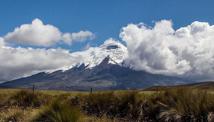
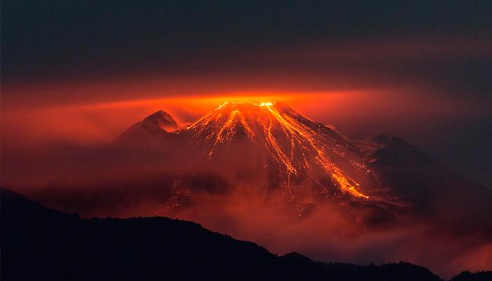
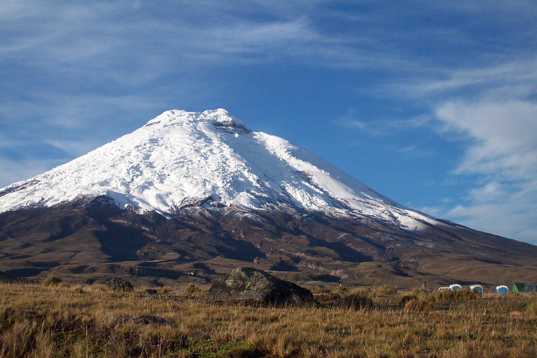
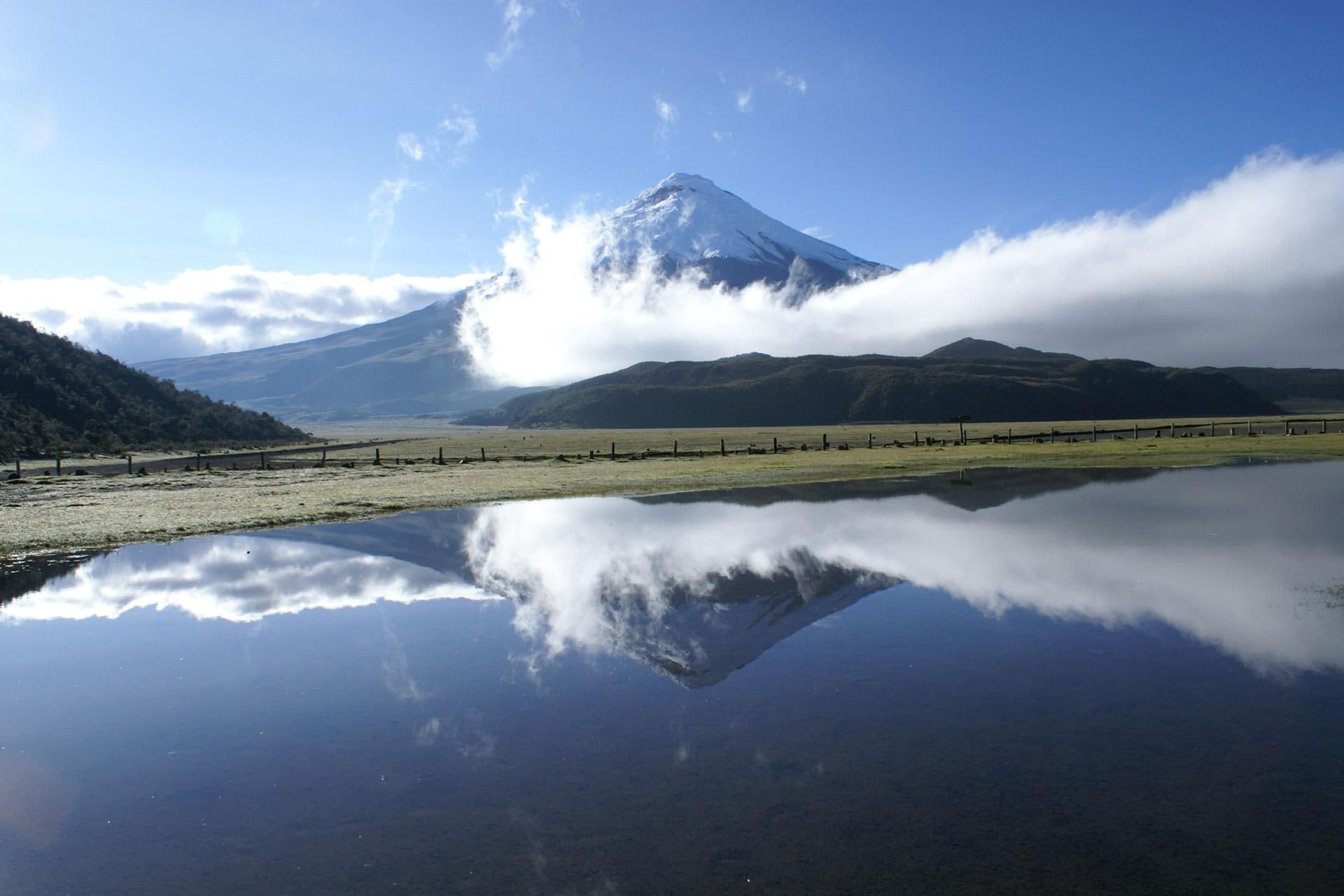
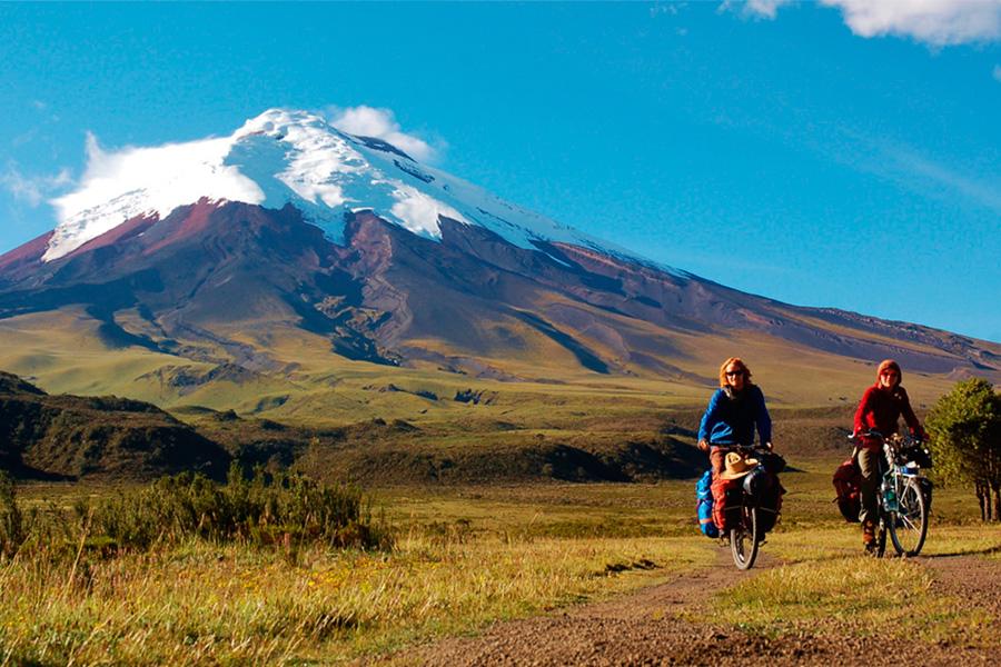
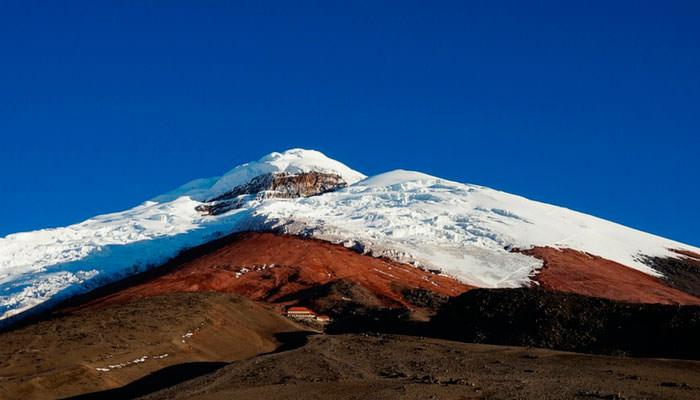
Cotopaxi Volcano, the iconic stratovolcano
- Latitude: 0.6838° S
- Longitude: 78.4372° W
- Elevation: 5911 m (maximum peak)
- Volcano Type: Stratovolcano
- State: Active
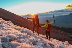
Cotopaxi is probably one of the most iconic volcanoes in Ecuador. A must visit for every Ecuador travelers, Cotopaxi is a majestic, snow covered symmetrical stratovolcano located in the Latacunga canton of Cotopaxi Province, about 50 km south of Quito, and 33 km northeast of the city of Latacunga. It is part of the Eastern Cordillera of the Ecuadorian Andes. Visitors to Cotopaxi National Park can enjoy a variety of activities including hiking, mountain climbing, mountain biking, mountaineering, horseback riding, camping, bird watching, wildlife watching, and site seeing.
TAKE A LOOK AT THIS 2-DAY COMBINATION TOUR OF COTOPAXI VOLCANO & QUILOTOA
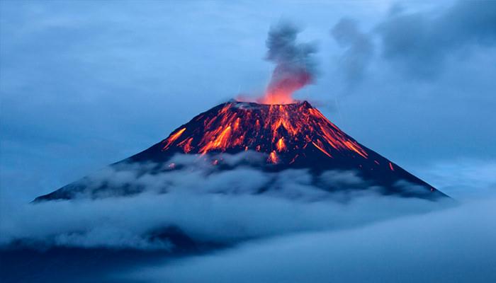
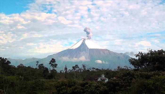
Tungurahua
- Latitude: 1 ° 28 ‘South
- Longitude: 78 ° 27 ‘West
- Elevation: 5023 m Located 33 kilometers southeast of Ambato, in the Cordillera Real of the Ecuadorian Andes
- State: Active
Tungurahua comes from Quichua tunguri (throat), rahua (fire), and it means “Throat of Fire” but it is also known as the “The Black Giant.” This active stratovolcano is located in the Cordillera Oriental of Ecuador. The volcano gives its name to the province of Tungurahua, home to the lovely town of Baños. A trip to Baños will allow you to catch sight of the still active volcano.
TAKE A LOOK AT THIS 2-DAY TRIP TO BAÑOS INCLUDING A VISIT TO COTOPAXI VOLCANO
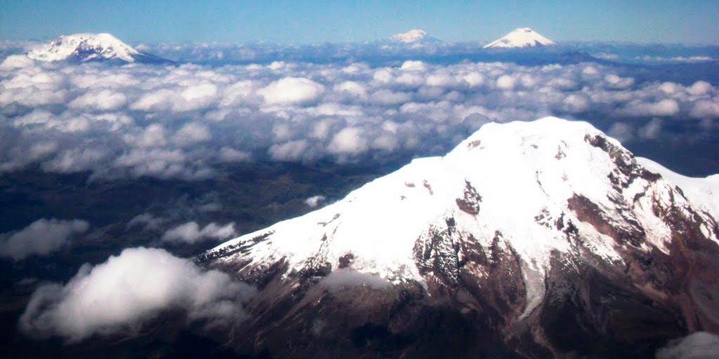
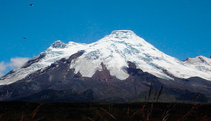
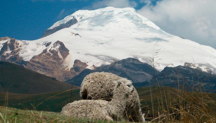
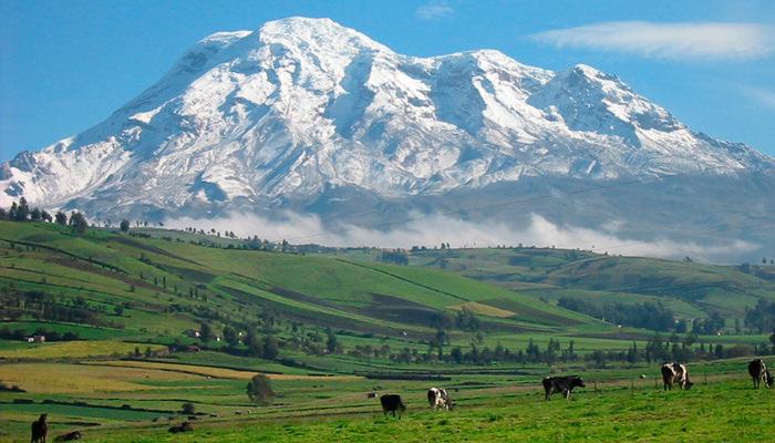
Chimborazo Volcano, the majestic sight
- Latitude: 1 ° 46 ‘South
- Longitude: 78 ° 82 ‘West
- Elevation: 6310 m (is the highest volcano in Ecuador)
- Located 30 kilometers NW Riobamba
- State: Potentially Active
Chimborazo is probably best known for being the highest point on the Earth above sea level, the summit of Chimborazo is the farthest place on the surface of the Earth from its exact center, a distance of 3,968 miles (6,384.4 kilometers). This massive, ice-capped stratovolcano lies at the southwest end of the main Ecuadorian volcanic arc, the so-called “Avenida de los Volcanes” (“Avenue of Volcanoes”). It is located ca. 150 km SSW of Quito and 28 km NW of the town of Riobamba. The Tren del Hielo day trip by Tren Ecuador allows you to come close with the stunning view of Chimborazo.
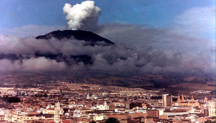
Guagua Pichincha
- Latitude: 0. 17 ° S
- Longitude: 78.60 ° W
- Elevation: 4794 m
- Volcano type: Strato volcano with avalanche caldera open to the W
- Alert: Yellow
- Last eruption: 2004
Guagua Pichincha is one of Ecuador’s most active volcanoes. This stratovolcano is part of a complex that rises immediately west of the capital Quito, at only 8 km distance from the city center.
Reventador
- Latitude: 0 ° 04 ’05” S
- Longitude: 77 ° 40 ’22” W 90 km east-northeast of Quito
- Diameter: 3-4 km
- Maximum elevation: 3485 m
- State: Active
Reventador is an active stratovolcano which lies in the eastern Andes of Ecuador. It lies in a remote area of the national park of the same name, which is Spanish for ‘exploder’ or ‘ripper’. Since 1541 it has erupted over 25 times, although its isolated location means that many of its eruptions have gone unreported.
Sangay
- Latitude: 2°
- Longitude: 77 ° 34 45 km SE of Riobamba G-1: 50000 A ‘
- Elevation: 5230 msnm State: Active
Sangay volcano is located in Sangay National Park, one of two natural UNESCO World Heritage Sites in Ecuador (the other is the Galapagos Islands). It hosts unique and pristine biological communities which cross a wide range of ecosystems, from high-alpine to sub-tropical and tropical rainforest.
Imbabura
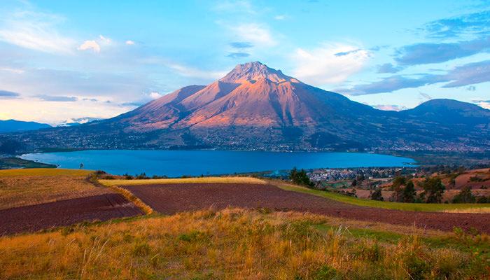
- Latitude: 0.36 N
- Longitude: 78.18 ° W
- Zone: 10 km to the southwest of Ibarra Elevation: 4620 m.s.n.m. (Taita Imbabura)
- Volcano Type: Composite stratovolcano
- Basal diameter: 16 km N-S x 14 km E-W
- State: Inactive
Imbabura greets you as you enter Imbabura province on your way to Otavalo or Cotacachi. It is one of the most beutiful sights on the Andean Sierra. Andean legends tell that Taita Imbabura (4.600 meters above sea level) was a young rogue, and fell in love with mama Cotacachi (4.944 meters above sea level). From their union the Yanahurco mountain, the Yaguarcocha and the San Pablo lagoons were born, reflecting their union forever. A 2-day trip to Otavalo and surroundings will give you enough time to come close to Imabura.
Sierra Negra in Isabela Island
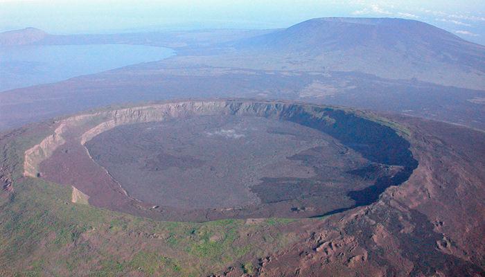
- Latitude: 0.83°S
- Longitude: 91.17°W
- Zone: South eastern end of Isabela Island Galapagos Islands Elevation: 1124 m
- Volcano Type: The caldera is structurally complex with a 14 km long ridge within it.
- Last eruption: 2005
- State: Active
The Sierra Negra Volcano in Isabela Island has the second largest crater in the world and is the only volcanic spot in Isabela Island open for travelers. Sierra negras is one of the most active volcanoes in the Galapagos, with the last eruption in 2016. There are day trips from Puerto Villamil to Sierra Negra and, though, you probably won’t see any flowing lava, you will have the opportunity to explore thermal vents and other fascinating geologic features in this highly active geothermal area. A hike here also offers and spectacular view of Elizabeth Bay and Isabela Island.
Alcedo
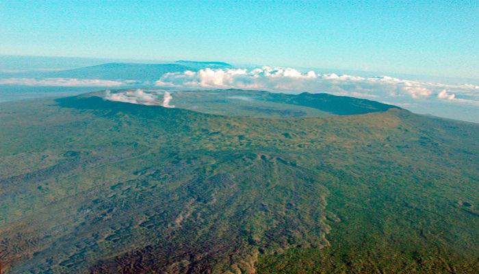
- Latitude: 0.26°S
- Longitude: 91.07°W
- Zone: Isabela Island Galapagos
- Elevation: 1130 m Volcano Type: The caldera measures 6.1 x 7.4 km
- Last eruption: 1993
This is one of the six coalescing shield volcanoes that build up Isabela Island in the Galapagos. Alcenot is athe only volcano in the Galapagos to have erupted rhyolite and basaltic lava. This spot is home to the largest number of wild tortoises of any of the volcanoes in the Galapagos, though their genetic diversity is amongst the lowest of any of the breeds in the archipelago. This site is, however, is not open for travelers.

Comments